


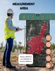
GPS Field Area Measurement is a versatile app designed to calculate and measure land areas with accuracy, making it an excellent tool for various professional and personal uses. By leveraging GPS technology, the app allows you to measure fields or plots of any shape or size directly through your mobile device. It supports calculations for triangles, rectangles, circles, polygons, and other geometric shapes, making it ideal for tasks ranging from agricultural planning to construction and land surveying.
A Reliable and User-Friendly Tool
This app provides a user-friendly interface, ensuring seamless navigation for users with varying levels of technical expertise. It is especially beneficial for farmers, construction surveyors, landscape designers, and urban planners. With its in-built GPS-based unit converter, you can measure and calculate land areas or distances in a variety of units, which is useful for both local and international applications. The app also supports real-time tracking, ensuring accurate results for precise field measurements.
Versatility for Land and Asset Management
GPS Field Area Measurement is particularly effective for activities such as farm boundary assessment, fencing, land asset mapping, and sports track measurements. You can use it for projects involving land construction, landscaping, and record management, ensuring precise calculations for a wide range of needs. By offering accessibility and dependable functionality, this app eliminates the need for manual measurements, saving time and reducing errors.
Use GPS Field Area Measurement to acquire detailed, accurate measurements for land areas and fields, ensuring efficiency and reliability in your projects.
Requirements (Latest version)
- Android 8.0 or higher required
Comments
There are no opinions about GPS Field Area Measurement yet. Be the first! Comment